
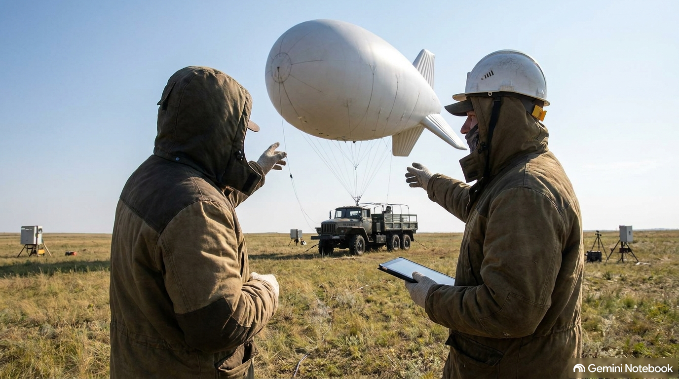
1. Introduction: The Dream of Stratospheric Connectivity
Imagine a fleet of solar-powered airships hovering quietly 20 kilometers above the Earth in the stratosphere, casting a continuous blanket of wireless coverage across thousands of square miles. For decades, telecommunications visionaries have touted High-Altitude Platform Stations (HAPS)—essentially floating cell towers in the sky—as the ultimate solution to eliminate rural dead zones without the staggering capital expense of building thousands of ground towers.
That dream erupted into global tech headlines when aerospace pioneer Sceye, alongside Japanese telecom giant SoftBank, completed a headline-grabbing trans-pacific flight test. Their solar-powered stratospheric airship logged nearly 30,000 kilometers over roughly 30 days, igniting intense curiosity across the wireless industry: Are floating blimps about to render terrestrial cell towers obsolete?
While the engineering achievement is unquestionably impressive, a rigorous look at the radio frequency (RF) physics, regulatory classifications, real-world economics, and carrier capital deployments reveals a far different reality.
Here are five surprising truths behind the stratospheric cell service hype.
2. Takeaway 1: Sceye’s Trans-Pacific Flight Was Historic—But It Flew as an "Unmanned Free Balloon"
Sceye’s test flight (Mission Service Test 1, or ST1) delivered an extraordinary technical trial. Launching from Roswell, New Mexico, on August 9, 2026, the airship crossed the Pacific Ocean in approximately 13 days (~15,000 kilometers), entering Japanese-managed airspace on August 23. Positioned offshore near Muroto City and Cape Muroto in Kochi Prefecture, the platform maintained a station-keeping position within a tight 5-kilometer radius for over seven days while connected to SoftBank’s core network via a ground gateway.
During its field operation, the platform achieved significant integration milestones:
Cellular Voice and Data: Delivered 4G LTE-equivalent base station connectivity, supporting smartphone voice calls, text messaging, video streaming, and two-way video calls.
Emergency Response Messaging: Successfully broadcast simulated earthquake and tsunami emergency alerts and completed test calls to Japan's maritime emergency service.
Remote Control and Onboard Processing: Supported remote drone flight controls and hosted an onboard mobile core and web server, recording a snappy average round-trip response latency of 68 milliseconds.
Round-Trip Voyage: Re-entered U.S. airspace in early September, completing a 30-day, 30,000-kilometer total journey.
However, industry observers must look closely at the official regulatory framework under which this journey occurred. During its trans-pacific crossing, the platform operated under an official classification that limits how the flight can be applied to commercial telecom operations.
"Sceye described the operating classification during the journey as an unmanned free balloon... the flight should not be interpreted as proof of an airline-style, actively navigated route throughout the trans-Pacific crossing."
Floating across an ocean as a drift balloon riding stratospheric winds is fundamentally different from operating an actively navigated, commercially scheduled route that can guarantee 24/7/365 station-keeping over a targeted market on demand.
3. Takeaway 2: "Coverage Is Not Capacity" (One Airship Replacing 500 Towers Is Misleading)
Following the flight trial, marketing claims widely highlighted that a full-scale Sceye platform could cover a geographic footprint equivalent to "up to 500 cell towers" (a dramatic leap from earlier IEEE Spectrum estimates of "up to 25 ground towers"). To property owners and investors, replacing hundreds of physical tower leases with a single floating airship sounds like an existential shift.
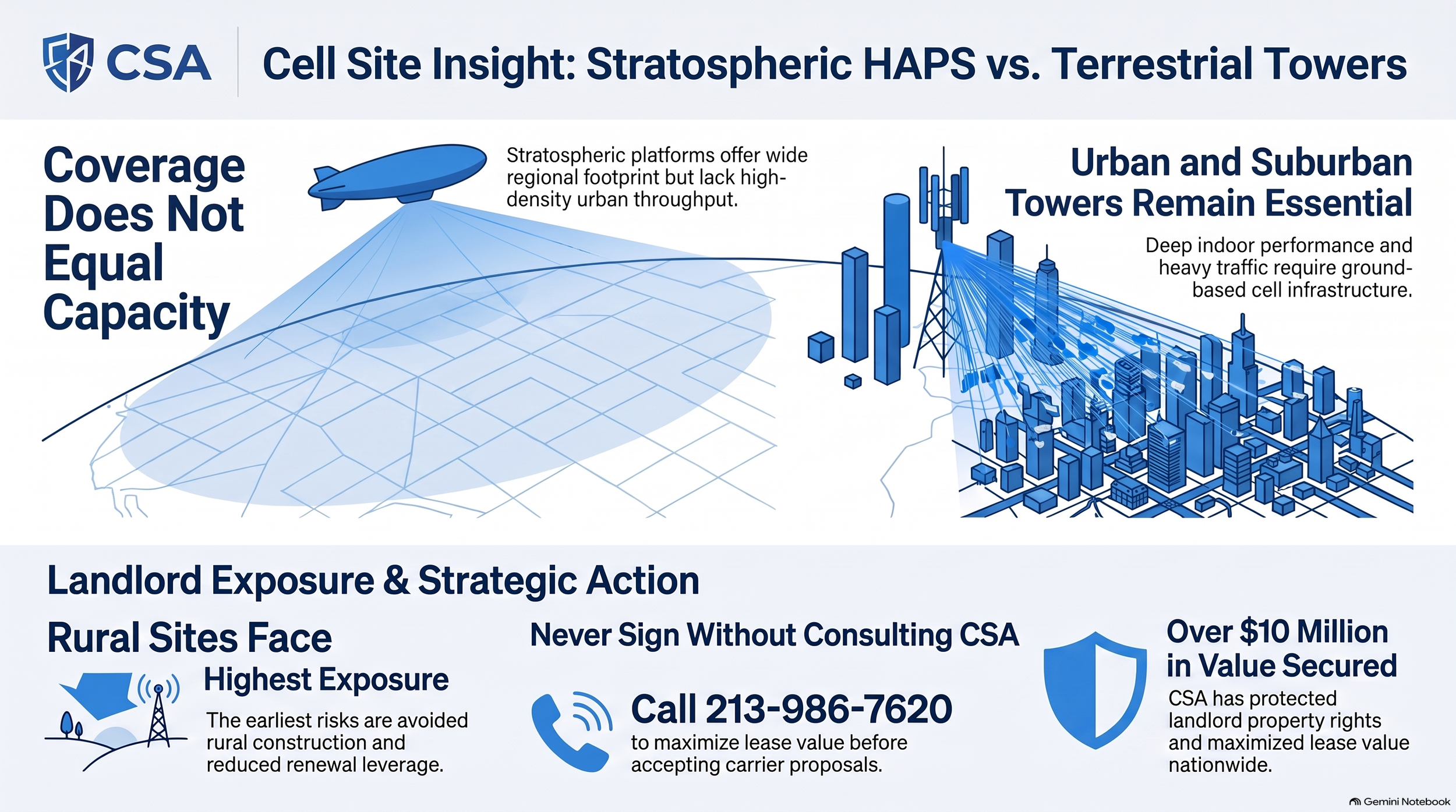
In reality, framing a single airship as a direct replacement for 500 ground sites is a marketing distortion. It conflates Coverage Geometry with Capacity Density:
Coverage Geometry: Refers strictly to line-of-sight signal reach. Sitting 20 kilometers in the air, an airborne radio has a vast physical line of sight across flat terrain.
Capacity Density: Refers to total data throughput, uplink performance, spectrum reuse, and the number of simultaneous users a network can handle during peak busy hours.
Two unavoidable radio frequency (RF) bottlenecks explain why stratospheric platforms cannot replace terrestrial capacity networks:
Feeder Link Bottlenecks: The service link between a smartphone and an airship is only as strong as the airship’s feeder link (backhaul) to its ground gateway. If ground-gateway feeder capacity or atmospheric conditions constrain the link, the entire high-altitude cell site suffers an aggregate throughput bottleneck regardless of how many square miles its signal reaches.
Spectrum Reuse and Interference Limits: Terrestrial networks deliver massive capacity by reusing the same spectrum frequencies over and over again across densely packed microcells spaced hundreds of meters apart. Because a stratospheric platform sits 20 kilometers above an entire region, its broad visibility creates severe co-channel interference with ground sites and neighboring airspaces. It cannot replicate the localized spatial spectrum reuse that powers modern mobile networks.
Furthermore, a platform operating at 4G LTE-equivalent speeds 20 kilometers up cannot deliver deep indoor penetration through reinforced concrete, nor can it handle the dense busy-hour traffic of urban business districts. Broad coverage geometry will never equal localized user capacity.
4. Takeaway 3: Major U.S. Carriers Are Betting Billions on Satellites, Not Airships
If stratospheric airships were on the verge of revolutionizing commercial wireless, America’s top carriers—AT&T, Verizon, and T-Mobile—would be allocating massive capital budgets toward airship fleet procurement. Yet public disclosures reveal zero signed commercial fleet orders, zero nationwide airship capital budgets, and zero commercial launch schedules for stratospheric airships among major U.S. operators.
Instead, carrier capital and strategic momentum are overwhelmingly backing Low Earth Orbit (LEO) direct-to-device (D2D) satellite constellations. On October 1, 2026, AT&T, T-Mobile, and Verizon announced a joint venture agreement focused on satellite-enabled coverage. This joint venture builds upon deep, pre-existing commercial partnerships:
T-Mobile: Actively expanding direct-to-cell deployment with SpaceX.
AT&T: Deeply committed to AST SpaceMobile.
Verizon: Partnered with Skylo and AST SpaceMobile.
Wireless observers often point to AT&T’s aerial assets as proof of airship adoption, but this confuses low-altitude tethered balloons with stratospheric HAPS. AT&T’s "FirstNet One" is a 55-foot low-altitude tethered aerostat operating at just 1,000 feet for emergency disaster response. Tethered aerostats rely on heavy ground cables to deliver direct fiber backhaul and continuous electrical power from the surface—entirely eliminating the extreme solar-generation, battery-weight, and wireless feeder-link constraints that stratospheric airships face.
Feature / Metric
Stratospheric HAPS Airships
LEO Direct-to-Device Satellites
Coverage Geometry
Regional, concentrated elevated platform (~20 km altitude)
Moving satellite constellation providing continuous broad global/national coverage
Deployment Status
Pre-commercial flight trials, station-keeping development, and testing
Rapidly scaling active satellite launches and commercial carrier rollouts
Major U.S. Carrier Backing
No signed commercial fleet orders or capital allocations identified
Multi-billion-dollar joint venture (AT&T, Verizon, T-Mobile) and commercial partnerships (SpaceX, AST, Skylo)
5. Takeaway 4: The $4.3M Cost Benchmark Is an Academic Model, Not a Commercial Price Quote
Financial discussions around high-altitude cell service frequently cite a discounted lifetime cost of approximately $4.371 million per platform as proof of economic superiority over ground towers. However, this figure is derived from a 2024 IEEE Communications Magazine research study—it is a theoretical academic model, not a commercial vendor quote.
The IEEE study based its $4.371 million lifetime calculation on narrow baseline assumptions:
A generic $4 million manufacturing capital cost per platform.
A 20-year asset life (modeled as a $200,000 annual capital allocation).
An assumed baseline operating expense of just $30,000 per year.
Crucially, the IEEE study contains a massive internal math discrepancy that deflates its reported total cost. In the body text of the paper, the authors explicitly acknowledge that annual maintenance for high-altitude platforms could reach up to 15% of manufacturing costs per year—or $600,000 annually for a 4 million airship. Yet, when generating its summary financial table, the study substituted an artificially suppressed operating expense of just 30,000 per year.
That $570,000 annual discrepancy completely undermines the $4.371 million lifetime benchmark.
Furthermore, academic models omit essential real-world capital requirements for a carrier-grade network, including:
Fleet Continuity and Redundancy: Maintaining spare airships to swap in during routine envelope maintenance, helium replenishment, or severe weather.
Ground Infrastructure: Construction of dedicated ground gateway terminal networks and fiber interconnects.
Flight Operations: Continuous 24/7 flight supervision crews, weather tracking, launch/recovery teams, and aviation insurance.
Network Integration: Carrier core integration, emergency 911 routing, and regulatory spectrum compliance.
Treating a flawed academic paper model as a bankable capital quote drastically understates the true commercial price of stratospheric service.
6. Takeaway 5: Cell Tower Landlords: Your Urban Rooftops Are Safe, But Rural Sites Face Leverage Shifts
For cell tower landlords and real estate investors, media hype about floating cell towers often triggers anxiety over potential lease cancellations. Analysis by Cell Site Appraiser (CSA) confirms that HAPS platforms represent a forward-looking lease renewal negotiation tactic by carriers rather than an active, observed trend of physical site terminations.
To evaluate actual site risk, landlords should apply CSA’s three-part analytical framework:
Technical Replaceability: Can an aerial signal match the site's actual busy-hour data throughput, uplink capacity, and indoor penetration? (Urban rooftops and dense macro sites fail this test—they cannot be replaced by an airship).
Economic Replaceability: Does switching to aerial coverage genuinely lower the carrier's total costs after factoring in gateway infrastructure, fleet redundancy, operational overhead, and lease exit costs?
Contractual Replaceability: Does the lease contract actually permit the carrier to terminate for convenience, and what are their specific restoration and notice obligations?
                    LANDLORD EXPOSURE MATRIX

  [LOW EXPOSURE]                           [HIGHER EXPOSURE]
  • Urban Rooftops & DAS                   • Proposed New Rural Builds
  • High-Density Macro Sites               • Low-Traffic Single-Tenant Rural
  • Suburban Capacity Hubs                 • Remote Coastal / Isolated Sites
As demonstrated above, multi-tenant urban towers and dense suburban capacity sites face virtually zero replacement risk. However, proposed new rural construction and low-traffic, single-tenant rural sites face higher exposure—carriers may opt to avoid building expensive new rural towers if aerial coverage can fulfill basic coverage mandates.
Landlords must remember the core economic rule governing site substitution:
"HAPS is preferable only when its complete, reliability-adjusted cost is below the cost of the terrestrial facilities and service obligations it actually avoids."
If a carrier tenant attempts to use stratospheric airship claims as leverage during lease renewal negotiations to demand rent reductions, landlords should insist on concrete proof across five specific items:
1. Named Operating Provider: The identity of the specific commercial aerial service provider supplying the replacement coverage.
2. Executed Commercial Contract: Proof of an executed, binding commercial service agreement (not a test trial, promotional partnership, or alliance membership).
3. Parity Technical Specifications: Verified capacity, busy-hour throughput, and uplink specifications proving performance parity with the existing ground site.
4. Regulatory Clearances: Active commercial operating permissions from relevant aviation (FAA) and telecommunications (FCC) regulatory bodies for the exact spectrum and geography.
5. Firm Implementation Timeline: A documented, scheduled turn-up timeline alongside verifiable avoidable ground-facility costs.
7. Conclusion: The Horizon for High-Altitude Wireless
The successful trans-pacific flight of solar-powered platforms like Sceye marks a fascinating engineering achievement in aerospace and high-altitude communications. As flexible tools for disaster response, maritime emergency backup, environmental sensing, and filling thin coverage gaps in geographically isolated regions, stratospheric airships possess real commercial promise.
However, floating blimps will not replace terrestrial cell towers. The unyielding laws of RF spectrum reuse, the necessity for deep indoor signal penetration, and the overwhelming financial backing behind LEO satellite constellations guarantee that ground-based cell towers remain the indispensable bedrock of global wireless infrastructure.
A Final Thought for Industry Observers: As carriers continue balancing their capital expenditures across terrestrial networks, orbiting LEO satellites, and stratospheric platforms, will HAPS airships successfully scale as a specialized regional overlay—or will direct-to-device satellite constellations capture remote coverage demand before airship fleets ever reach commercial scale?